
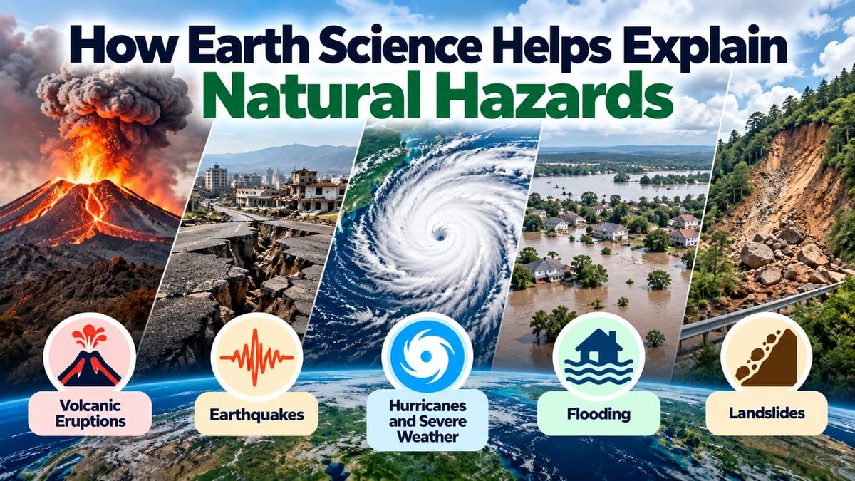
How Earth Science Helps Explain Natural Hazards
Earth is a dynamic planet. Continents move, mountains rise, rivers change their courses, oceans circulate, and the atmosphere constantly shifts. These processes shape the landscapes people live in, but they can also produce natural hazards.
Earthquakes, volcanic eruptions, landslides, floods, hurricanes, droughts, wildfires, and tsunamis can cause major damage to communities and ecosystems. Although these events can be destructive, they are not completely mysterious. Scientists can investigate the physical processes behind them and use that knowledge to understand where hazards are likely to occur, how they develop, and what risks they may create.
Earth science provides the foundation for this understanding. By studying the planet’s rocks, atmosphere, water, landforms, internal structure, and biological systems, scientists can explain many of the natural processes responsible for hazards.
What Is Earth Science?
Earth science is the study of Earth and the physical processes that shape the planet.
It includes several interconnected fields, including:
- Geology
- Geophysics
- Meteorology
- Oceanography
- Hydrology
- Climatology
- Soil science
- Geochemistry
- Earth system science
These disciplines examine different parts of the planet, but natural hazards often involve several of them at the same time.
For example, a hurricane primarily involves atmospheric and oceanic processes, while a landslide may involve geology, rainfall, soil, vegetation, and gravity.
The Earth Science and Geology Complete Guide provides broader context on the scientific disciplines used to understand Earth’s structure and processes.
Why Natural Hazards Happen
A natural hazard is a naturally occurring process or event that has the potential to harm people, infrastructure, property, or ecosystems.
The event itself is not necessarily a disaster.
A strong earthquake occurring far from populated areas may cause little human damage, while a smaller earthquake beneath a densely populated city can have much greater consequences.
This distinction is important because hazard and risk are related but different concepts.
Earth science helps explain the hazard itself, while information about population, infrastructure, land use, and vulnerability helps determine the resulting risk.
Earth’s Internal Structure and Natural Hazards
Earth is not a static ball of rock.
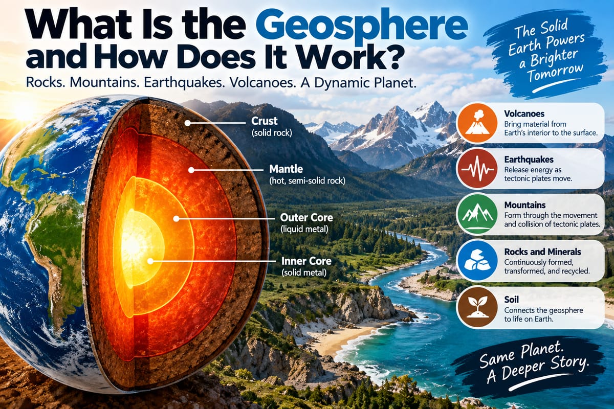
Its interior contains several layers with different physical and chemical characteristics. Heat remaining from Earth’s formation, along with heat generated by radioactive processes, drives geological activity deep inside the planet.
These processes contribute to the movement of Earth’s tectonic plates.
A broader look at Earth’s development and planetary systems can be found in How Earth Formed and How Its Planetary Systems Work.
Understanding Earth’s internal structure helps scientists explain why some regions experience frequent earthquakes, volcanic activity, and mountain-building processes.
Plate Tectonics and Earthquakes
Earth’s outer solid layer is divided into large tectonic plates.
These plates move slowly over geological timescales. Where plates interact, enormous stresses can accumulate within rocks.
When built-up stress is released suddenly along a fault, the resulting movement can generate an earthquake.
Earth scientists study:
- Fault locations
- Plate boundaries
- Rock structures
- Historical earthquakes
- Seismic waves
- Ground deformation
- Patterns of geological activity
This information helps scientists identify areas with significant earthquake hazards.
Scientists cannot generally predict the exact time, location, and magnitude of a future earthquake with enough reliability to provide precise advance warnings. However, geological and seismic research can help identify regions where earthquake hazards are more significant.
How Seismic Waves Reveal What Happens Underground
Earthquakes produce seismic waves that travel through the planet.
Different types of seismic waves move through materials in different ways.
By recording these waves with instruments called seismometers, scientists can study:
- Where an earthquake originated
- How much energy was released
- How seismic energy traveled
- Characteristics of underground materials
- Earth’s internal structure
Seismic observations therefore provide information about both individual earthquakes and the deeper structure of the planet.
Volcanoes and Earth’s Internal Heat
Volcanic activity is another hazard connected to Earth’s internal processes.
Magma forms or accumulates beneath Earth’s surface under particular geological conditions. When magma reaches the surface, it can produce lava flows, ash, gases, and other volcanic materials.
Volcanoes occur in several geological settings, including areas associated with tectonic plate boundaries and regions where hot material rises from deeper within Earth.
Earth scientists monitor volcanoes by examining:
- Earthquake activity
- Ground deformation
- Gas emissions
- Heat changes
- Changes in volcanic lakes
- Surface activity
These observations can sometimes provide evidence that a volcanic system is becoming more active.
Why Volcanic Ash Can Be Dangerous
Volcanic hazards extend beyond lava.
Explosive eruptions can release ash high into the atmosphere. Volcanic ash consists of extremely fine particles of fragmented volcanic material.
Ash can affect:
- Human health
- Agriculture
- Water supplies
- Machinery
- Buildings
- Transportation
- Aircraft
Understanding the chemistry, particle size, movement, and distribution of volcanic material allows scientists to evaluate potential impacts.
Landslides and the Role of Gravity
Landslides occur when rock, soil, or other material moves downslope under the influence of gravity.
They can happen gradually or very rapidly.
Several factors can contribute to landslides, including:
- Steep slopes
- Heavy rainfall
- Earthquakes
- Volcanic activity
- Erosion
- Weak or fractured rocks
- Soil saturation
- Changes in vegetation
- Human modification of slopes
Earth scientists examine the geology and shape of slopes to identify conditions that may increase landslide susceptibility.
Why Rainfall Can Trigger Landslides
Water can significantly change the stability of soil and rock.
When heavy rainfall enters the ground, it can increase the water content of soil and raise pressure within spaces between soil particles. In some circumstances, this reduces the forces holding a slope together.
If the forces driving movement become greater than the forces resisting it, a slope can fail.
This is one reason landslide hazards can increase following prolonged or intense rainfall.
Flooding and the Movement of Water
Flooding occurs when water covers land that is normally dry.
Earth science helps explain flooding by examining how water moves through landscapes.
Important factors include:
- Rainfall intensity
- River capacity
- Drainage systems
- Soil characteristics
- Groundwater
- Topography
- Vegetation
- Snow and ice
- Coastal conditions
Hydrologists can use observations and models to understand how water moves through watersheds and how particular weather events may affect rivers and drainage systems.
Why Some Places Flood More Easily
Flood risk varies considerably between locations.
Low-lying areas near rivers may naturally be more exposed to flooding. Urban areas can also experience increased runoff because roads, roofs, and other impermeable surfaces prevent water from soaking into the ground as easily.
Wetlands, forests, floodplains, and other natural features can influence how water is stored and transported.
Understanding these relationships can help communities make better decisions about land use and flood management.
Weather Science and Severe Storms
The atmosphere is constantly moving.
Differences in temperature, pressure, humidity, and wind create weather systems ranging from ordinary rainstorms to powerful tropical cyclones.
The Complete Guide to Earth’s Atmosphere, Weather and Air provides a broader look at the atmospheric processes that shape weather.
Meteorologists use observations from satellites, weather stations, radar, aircraft, and other instruments to monitor atmospheric conditions.
These observations are essential for understanding severe weather.
Hurricanes and Tropical Cyclones
Tropical cyclones form under specific atmospheric and oceanic conditions.
Warm ocean water can provide energy to developing systems, while atmospheric circulation influences their organization and movement.
Scientists monitor factors such as:
- Sea-surface temperatures
- Atmospheric pressure
- Wind speed
- Wind direction
- Humidity
- Storm structure
- Ocean heat
Weather models combine these observations with mathematical representations of atmospheric processes to estimate how storms may develop and move.
Storm Surge and Coastal Hazards
A tropical cyclone can create coastal hazards beyond strong winds.
Storm surge occurs when seawater is pushed toward the coast by a storm’s winds and atmospheric pressure.
The resulting water level depends on several factors, including:
- Storm intensity
- Storm size
- Direction of movement
- Coastal shape
- Water depth
- Tides
- Local geography
Earth science helps researchers understand how coastal landscapes interact with storm-driven water.
Tsunamis and Underwater Disturbances
Tsunamis are long waves generated by large disturbances that displace significant amounts of water.
Underwater earthquakes are one important cause, particularly when the seafloor moves vertically.
Other possible causes include:
- Submarine landslides
- Volcanic eruptions
- Certain large impacts
Once generated, tsunami waves can travel across ocean basins.
As they approach shallower water, their behavior changes and wave heights can increase under appropriate conditions.
Scientists use seafloor measurements, earthquake information, ocean observations, and mathematical models to understand tsunami behavior and support warning systems.
Drought and the Water Cycle
Not all natural hazards involve sudden events.
Drought can develop over weeks, months, seasons, or longer periods when water availability remains significantly below normal for a particular region and its needs.
Earth science helps explain drought through the water cycle.
Scientists examine:
- Precipitation
- Evaporation
- Soil moisture
- Groundwater
- River flow
- Snowpack
- Temperature
- Atmospheric circulation
Drought can affect agriculture, water supplies, ecosystems, energy production, and communities.
Wildfires and Environmental Conditions
Wildfires are natural phenomena in many ecosystems, although human activity can also influence their occurrence and spread.
Earth science helps explain how environmental conditions affect fire behavior.
Important factors include:
- Temperature
- Wind
- Humidity
- Vegetation
- Soil moisture
- Topography
- Recent precipitation
- Drought conditions
Dry vegetation can provide fuel, while strong winds can help fires spread rapidly.
The shape of the landscape also matters because fire behavior can change when flames move uphill or encounter different vegetation types.
Ecosystems Can Influence Hazard Conditions
Natural hazards do not occur independently of living systems.
Vegetation can influence soil stability, water movement, erosion, and fire behavior. Wetlands can store water, while forests can influence runoff and soil conditions.
The How Ecosystems Work and Stay Balanced guide provides broader context on the relationships among organisms, habitats, energy, and environmental processes.
These ecological relationships are important when assessing hazards because changes in an ecosystem can sometimes alter how landscapes respond to environmental stress.
Erosion and Changing Landscapes
Erosion is the movement of soil and rock by agents such as water, wind, ice, and gravity.
Although erosion often occurs gradually, it can contribute to hazards over time.
For example, erosion can:
- Undercut slopes
- Remove protective soil
- Alter river channels
- Change coastlines
- Increase sediment movement
- Destabilize exposed areas
Earth scientists study sediment, landforms, river systems, coastlines, and geological structures to understand how landscapes change.
Glaciers and Ice-Related Hazards
Ice is another important part of Earth’s physical system.
Glaciers move slowly across landscapes, carrying rock and sediment with them. Changes in glaciers can influence water availability, landscapes, and sea level.
Ice-related hazards can include:
- Avalanches
- Glacial lake outburst floods
- Ice falls
- Rapid changes in mountain environments
Scientists monitor glaciers using satellite imagery, field measurements, aerial surveys, and other techniques.
How Scientists Study Natural Hazards
Modern hazard science combines observations from many sources.
Scientists may use:
- Satellites
- Seismometers
- Weather stations
- Radar
- GPS measurements
- Ocean buoys
- Geological surveys
- Ground sensors
- Aircraft observations
- Laboratory analysis
- Computer models
Each method provides a different piece of information.
For example, satellites can reveal changes over large areas, while ground instruments can provide highly detailed measurements at specific locations.
Combining these observations creates a more complete understanding of natural processes.
The Role of Computer Models
Computer models are increasingly important in Earth science.
A model represents physical processes mathematically and allows scientists to examine how systems may behave under different conditions.
Models are used to study:
- Storm development
- Flooding
- Earthquake effects
- Volcanic activity
- Tsunami propagation
- Wildfire spread
- Climate patterns
- Water availability
Models are not perfect predictions of the future. Their usefulness depends on the quality of the underlying data, the assumptions incorporated into the model, and the complexity of the physical system.
Nevertheless, they are valuable tools for exploring possible scenarios.
Monitoring Can Provide Early Warning
Some natural hazards can be monitored closely enough to provide warnings before the most dangerous conditions arrive.
Weather forecasting can provide advance notice of many severe storms. Tsunami warning systems can detect large undersea earthquakes and assess the possibility of tsunami generation. Volcano monitoring can identify changes associated with increasing activity.
Earthquake early-warning systems in some regions can detect the first arriving seismic waves and issue alerts before stronger shaking reaches more distant locations.
The amount of warning available varies greatly between hazards.
Some events develop slowly enough for substantial preparation, while others occur with little advance notice.
Hazard Maps Show Where Risks May Be Higher
Scientists can combine geological, geographical, and historical information to create hazard maps.
These maps may identify areas exposed to:
- Earthquake shaking
- Volcanic activity
- Flooding
- Landslides
- Wildfires
- Coastal hazards
- Tsunamis
Hazard maps do not guarantee that an event will occur in a particular location. Instead, they show where certain physical conditions or historical patterns indicate greater potential exposure.
They can help inform decisions about infrastructure, emergency planning, land use, and building standards.
Natural Hazards and Human Development
Human activity can influence how natural hazards affect communities.
Building on floodplains, removing vegetation from unstable slopes, expanding cities into wildfire-prone areas, or constructing infrastructure in exposed coastal locations can increase vulnerability.
At the same time, engineering, planning, monitoring, and preparedness can reduce the consequences of hazards.
This means that Earth science is not only about understanding natural processes. It can also provide information that helps societies adapt to those processes.
Why Understanding Hazards Matters
Natural hazards cannot always be prevented.
Earthquakes will continue to occur because tectonic plates continue to move. Weather systems will continue to develop because the atmosphere and oceans remain dynamic. Rivers will continue to respond to rainfall, and slopes will continue to respond to gravity.
The practical goal is therefore often to understand these processes well enough to reduce avoidable harm.
Scientific knowledge can support:
- Better building practices
- More informed land-use planning
- Improved forecasting
- Emergency preparedness
- Evacuation planning
- Infrastructure design
- Environmental management
- Public education
Earth Science Connects Many Natural Systems
One of the most important lessons from natural hazards is that Earth’s systems are interconnected.
A storm involves the atmosphere and ocean. A flood involves precipitation, rivers, soil, and landscape. A landslide may involve geology, water, vegetation, and gravity. A tsunami can begin with geological activity beneath the ocean and become a coastal hazard many hundreds or thousands of kilometers away.
Studying these connections allows scientists to move beyond simply describing disasters.
They can investigate the physical processes that create hazards, identify environmental conditions that increase their likelihood or severity, monitor changes over time, and develop better ways to communicate potential risks.
Understanding the Planet Helps Communities Prepare
Earth science provides a framework for understanding why natural hazards occur and why their effects vary from place to place.
Geology reveals the forces shaping Earth’s solid surface. Atmospheric science explains severe weather. Hydrology shows how water moves through landscapes. Oceanography helps explain coastal and marine hazards. Ecology reveals how living systems interact with physical environments.
No single discipline explains every natural hazard. Together, however, the Earth sciences provide a detailed picture of a constantly changing planet.
The more clearly those natural processes are understood, the better scientists, planners, engineers, and communities can recognize hazards, prepare for possible events, and reduce unnecessary exposure to them.



2 Comments
Micle harison
June 7, 2019Lorem ipsum dolor sit amet, usu ut perfecto postulant deterruisset, libris causae volutpat at est, ius id modus laoreet urbanitas. Mel ei delenit dolores.
John Doe
June 7, 2019Some consultants are employed indirectly by the client via a consultancy staffing company.